Construction Progression
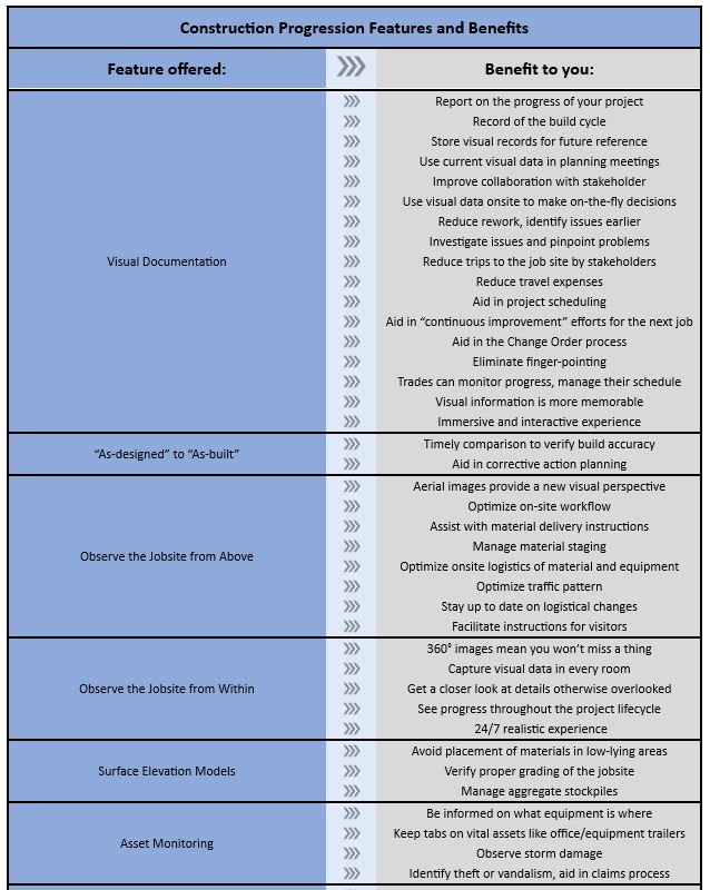
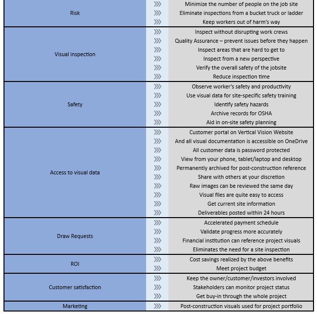
Why do you need visual documentation?
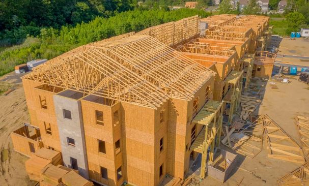
Construction drones are used in construction projects in a variety of ways such as building inspections, volume calculations, topographical mapping, progress monitoring and more. Aerial flyovers and 360-degree walkthroughs help reduce the time and cost associated with traditional manual inspection methods, increases safety and provide more accurate results.
Visual documentation keeps projects on schedule, on budget and everyone well-informed. Take a look at the features we offer and their benefits to you and every stakeholder involved with the project.
Visual documentation workflow consists of:
Capture – photo and video capture of jobsite
Analyze – post-production of visual data is compiled
Share – stakeholders get access to all deliverables requested
For an example of a construction project, Click here.